Tropical Storm Debby is anticipated to develop and bring heavy rainfall to Florida
Tropical Storm Debby, which has not yet formed but may bring days of intense, flood-causing rain to Florida and the southeast of the country beginning this weekend, has prompted the issuance of a tropical storm warning and the declaration of a state of emergency in some areas of the state.
According to the warning, tropical storm conditions should develop in 36 hours. The watch indicates that tropical storm conditions could develop in the next 48 hours.
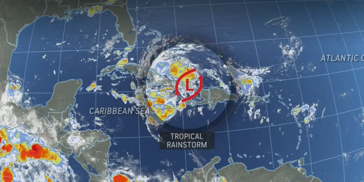
As the system consolidates over portions of Cuba and the southern Bahamas on Friday, the National Hurricane Center has classified it as Potential Tropical Cyclone Four with winds of up to 30 mph.
According to the most recent NHC forecast, this storm is expected to transform into Tropical Depression Four by Saturday morning and Tropical Storm Debby before making landfall in Florida on Sunday or Sunday evening. From there, if it stays over sea, it is predicted to track close to the Southeast coast early the next week, when it may intensify once more.
Residents in those areas are advised to get ready for tropical storm conditions throughout the next 48 hours. A tropical storm watch and tropical storm warning are in effect for portions of the Florida Keys and the Central Florida coast, respectively, extending from East Cape Sable to Bonita Beach. Tampa Bay, Cape Coral, and Fort Myers are all under observation.
The precise path and intensity of the storm are still unknown. The system's strength will depend on how long it remains over the eastern Gulf of Mexico's record-warm water.
“Since the forecast track is almost parallel to the west coast of the Florida Peninsula and the southeast coast of the US, only a small change in the track could lead to large changes in which land areas receive any landfalls and the biggest impacts,” the National Hurricane Center cautioned Friday.
As the system gathers just off the coast on Saturday, much of South Florida is at risk of flooding rainfall, with a level 2 of 4 risk, according to the Weather Prediction Center.
“Very intense” rainfall rates of 2.5 to 3 inches per hour are possible within the heaviest storms in the system’s outer rain bands Saturday, the WPC warned. Rainfall rates this potent are enough to cause flash flooding, even in marshy areas of the state more capable of handling excess water.
Up to eight inches of rain could fall across most of Florida, as well as the coasts of Georgia and the Carolinas, through Monday. However, total rainfall may rise sharply if the system were to stall.
Research from the National Hurricane Center indicates that in the past ten years, flooding brought on by precipitation, or freshwater flooding, has emerged as the most deadly feature of tropical systems.