Storm system brings strong thunderstorms and large hail to the Midwest and South

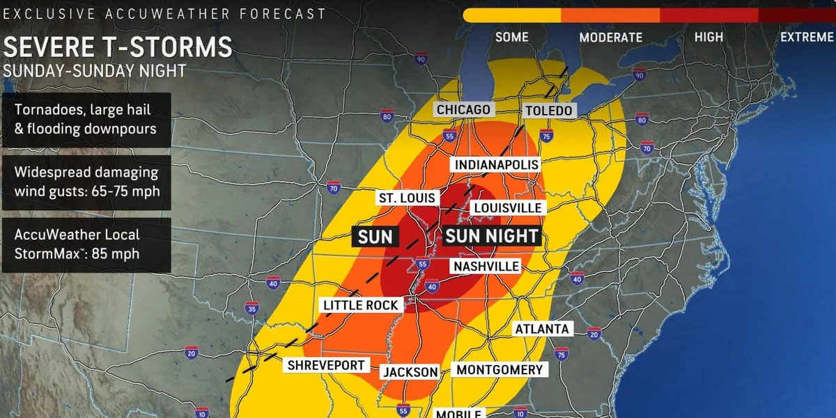
A volatile weather system is expected to bring severe thunderstorms to the central United States on Sunday, with the possibility of tornadoes, huge hail, and destructive winds.
The biggest danger for Sunday extends from northeastern Texas and northern Louisiana to Mississippi, northwestern Alabama, Illinois, Indiana, Ohio, and southern Michigan, potentially affecting over 39 million people.
The Storm Prediction Center has designated these locations as having an increased risk rating of three out of five on the severe weather scale.
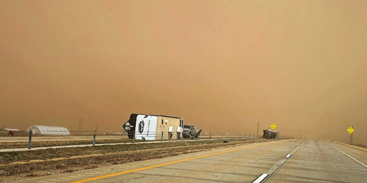
This storm system has been affecting sections of the Midwest and South throughout the weekend, with over 50 preliminary destructive wind and hail reports across the Plains on Saturday, including a 3-inch hail report in Amber, Oklahoma.
On Sunday, the National Weather Service's Storm Prediction Center warned of an increased danger of severe weather in the lowlands going into the area where Arkansas, Louisiana, and Texas intersect. The danger region includes Detroit, Indianapolis, Memphis, Nashville, Chicago, Dallas, and Cleveland.
“Very large hail, significant damaging winds (especially into the evening hours), and tornadoes, a few of which could be strong, can all be expected,” the National Weather Service said in an update Sunday morning. It also warned there could be “heavy downpours” as storms grow into a “organized line into the evening hours” and bring the risk of scattered flash flooding.
The volatile configuration is being pushed by a cold front connected to a storm system moving over the Great Lakes, which will meet with warm, moisture-rich air in the South, generating ideal conditions for violent thunderstorms.
The threat is likely to grow Sunday evening when storms form in Missouri and Illinois and spread to Arkansas, Louisiana, and Texas, as well as the Lower Mississippi and Tennessee Valleys.
The Storm Prediction Center predicts that the severe weather will continue throughout Sunday night as storms merge into larger and more violent outbreaks.
This line of severe storms will continue to move east Monday, affecting 68 million people in the Southeast and mid-Atlantic. The fiercest storms will hit Alabama, Georgia, the Carolinas, and Virginia, where there is an increased chance of damage.
Charlotte and Raleigh, North Carolina; Atlanta; Philadelphia; Washington, D.C.; and New Orleans are among the cities in the risk zone on Monday. Widespread damaging winds and a few tornadoes are expected in the afternoon and evening before the severe line moves offshore.
Forecasters also predicted that huge hail, up to three inches in diameter, will fall in northeastern Texas, northern Louisiana, Arkansas, southeastern Missouri, Southern Illinois, and western Ohio. Parts of western Kentucky and Tennessee may also be vulnerable.
On Monday, the risk of severe weather shifts eastward. The highest risk will extend from Virginia southwestward into Alabama, Georgia, and the Florida Panhandle, where storms are predicted to be more severe.
Strong wind gusts will pose the most serious threat to the Northeast, including sections of New York. Farther south, storms are predicted to be accompanied by tornadoes and big hail.
The Storm Prediction Center has assigned an elevated risk rating of three out of five to southern Alabama, Georgia, South Carolina, North Carolina, and parts of Virginia for severe weather on Monday and Tuesday.


