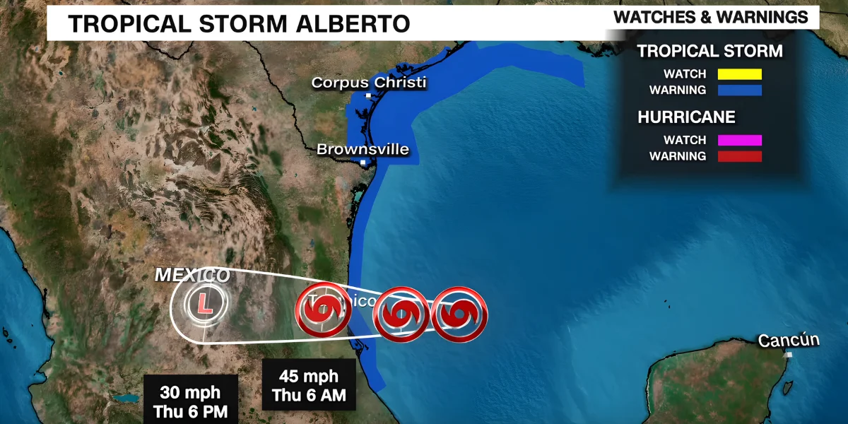
Tropical Storm Alberto forms over the Gulf of Mexico as the Atlantic hurricane season begins

According to the National Hurricane Center, the first tropical storm of the Atlantic season developed over the Gulf of Mexico on Wednesday. Alberto is the new name for the tropical storm.
Through Thursday, the storm is expected to deliver strong winds, coastal floods, and heavy rain to the shores of northeastern Mexico and Texas, according to forecasters. Alberto should arrive at the Mexican coast either early on Thursday or late on Wednesday.
A Tropical Storm Warning was issued for the northeastern Mexican coast, extending from the mouth of the Rio Grande to Puerto de Altamira, and the Texas coast, extending from the San Luis Pass south to the mouth of the Rio Grande.
With a potential total of 15 inches, rainfall quantities of 5 to 10 inches are probable from northeastern Mexico into southern Texas. This would most likely cause "considerable flash and urban flooding along with new and renewed river flooding." In northeastern Mexico, mudslides might potentially occur in higher terrain, according to meteorologists. Some sections of the Texas coast could be affected by storm surges up to four feet high.
Forecasters estimate between six and ten inches of rain will fall in south Corpus Christi, which is likely to receive the most rain. In Galveston and Surfside Beach, where there has already been significant flooding, storm surge is also predicted.
The majority of storm activity usually occurs in the later months of that window, between mid-August and mid-October, when the Atlantic hurricane season technically begins on June 1 and ends at the end of November.
